10 apps and tools for monitoring a location or local patch
A list of resources for regional and hyperlocal reporters keeping watch over a local patch, also useful for tracking breaking news in a specific location
– 6 min read
A list of resources for regional and hyperlocal reporters keeping watch over a local patch, also useful for tracking breaking news in a specific location
This article was migrated from an old version of our website in 2025. As a result, it might have some low-quality images or non-functioning links - if there's any issues you'd like to see fixed, get in touch with us at info@journalism.co.uk.
As little as 10 years ago, local journalists were mostly reliant on their (hard-copy) contacts book and a telephone to find and pursue stories.
Nowadays, digital innovations in social media, mobile and geo-location technology means there's more information at our fingertips than ever before when it comes to monitoring a local patch.
So while the power of making and maintaining contacts should never be underestimated, here are 10 location-based apps and tools to help with newsgathering, tracking breaking stories or curation.
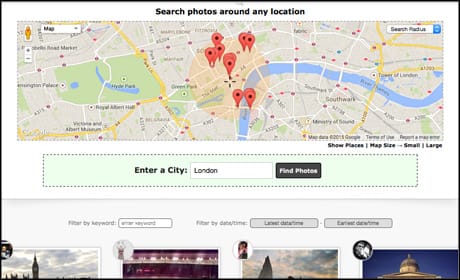
This web tool allows users to discover social media posts within a certain location by drawing a shape on a map, catching all geo-tagged uploads within that area, not just the ones using a particular hashtag.
The platform pulls in content from networks including Twitter, Instagram and Facebook, and users can filter results by format (photo and video, just video, or text). You can also search results by hashtag or keyword, see results from the previous seven days, and receive location alerts based on keywords direct to your email inbox.
With a free account, users can track three locations within a one-mile radius. Premium accounts, starting from $9 (£6) a month, offer more locations and the ability to engage with social media content without leaving the site.
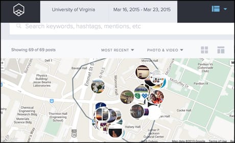
Screenshot from GroundSignal.com
If This Then That, also know as IFTTT, is a free web tool for automating actions between two apps – in this case Twitter and email.
This Recipe, embedded below, allows users to input a city, postcode or street name to receive a daily email of all that tweets posted within this area (providing the user has enabled geolocation on their Twitter account).
For more IFTTT Recipes for journalists, including advice on how to create your own, see this recent Journalism.co.uk story .
Twitter lists and advanced location searches Twitter lists are invaluable for keeping track of notable people, companies, sevices and institutions in your local area. A list of official sources, such as emergency services, charities, trusted individuals and other news outlets could make it much easier to quantify and verify information in the case of a breaking news event, for example.
Once you've taken the time to curate a few Twitter lists, organise them in Tweetdeck, where you can also set up columns monitoring mentions of your area either using a hashtag or an advanced search operator. For example, to search for mentions of the forthcoming general election near Birmingham I would use:
.
You will tend to get a lot of results for location-based searches, but you can filter them to surface more important information by excluding retweets, and choosing only to show tweets that have had higher levels of engagement.
See this Journalism.co.uk screencast for more information on using Tweetdeck for advanced searches and monitoring .
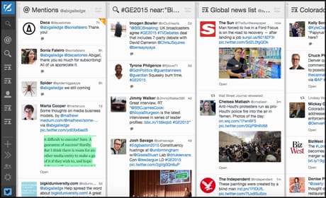
Screenshot from Tweetdeck Banjo A free app for iOS and Android, Banjo allows you to see a map of where and what people are posting to Twitter, Facebook and Instagram, either near you or in any location around the world.
Handy for tracking social media content while you're away from your desk, you can also translate social media posts into your language, and see what news and events are trending in a particular area.
Screenshot from Banjo
Instagram now has more than 200 million users , making it a good source for user-generated content and eyewitness media around breaking news and events. However, it's not always easy to find what you're looking for using the app's native search function.
Gramfeed, a free web tool, makes it possible to search images posted around a certain location, and filter them further by date or time. You can also search by hashtag or user, if you wish.
A lot of Instagram posts are also geolocated, which makes verification easier.
Screenshot from Gramfeed Geofeedia Used by outlets including CNN, Associated Press and the BBC, this paid-for (and pricey) platform allows users to surface tweets, photos and videos around a chosen location in real-time.
Geofeedia displays posts from networks including Twitter, Facebook, Instagram, Youtube and Flickr and also makes it possible to see multiple locations in one view.
Like Ground Signal, you can geo-fence an area on a map to pull in content. Another nice feature is the ability to curate content from a location and place it on an interactive map which can then be embedded into your site.
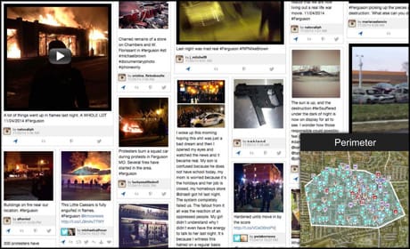
Geofeedia stream tracking the Ferguson incident in November 2014 (courtesy of Geofeedia.com)
One of the startups in the recent SXSW Accelerator competition , this free iOS app, still in beta, allows users to create a newsfeed specific to their location.
The app works via 'spots' varying in size from a 'room' to a 'block' to a 'stadium'. You can search for spots near you or create your own, but one catch is that you can only do so around a location where you physically are. StickyPop also operates a "24-Hour Rule", meaning you can only interact with a spot after you have left its radius.
StickyPop is sparsely populated at the moment, being so new, but it's certainly one to keep an eye on and – as the radius it covers is fairly small – would probably work best for journalists at the scene of a breaking news incident or other big event.
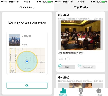
Screenshot from StickyPop
This UK site allows users to search Freedom of Information requests by keyword, date or location, making it a great resource for generating story ideas and keeping tabs on what issues are important to local residents.
Perhaps more importantly, you can also see whether a request has received a response.
Users can also submit FOI requests through the site, which is run by the non-profit organisation My Society and recently passed 250,000 registered requests .
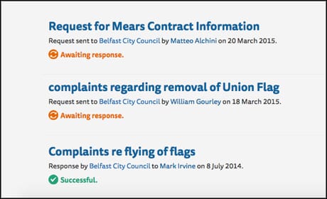
Screenshot from What Do They Know?
Though designed for UK residents to report issues to their local authority, anyone can enter a postcode into the website to see where problems have been reported, from potholes and broken streetlights to fly-tipping and dog fouling.
You can also create an RSS feed for a particular area or council ward, which is useful to see if an issue is re-occuring or has not been dealt with.
There is also a Fix My Street app available on iOS and Android.
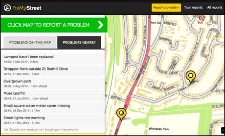
Screenshot from Fix My Street
An old favourite, Google Alerts allows users to receive email notifications for certain keywords in Google's search results, and are an efficient way to track news around a certain location.
To create an alert, input your search query and choose whether you want to receive all results or just content from categories like news, blogs and video. You can also decide how often you want to receive notifications – daily, weekly, or as they happen.
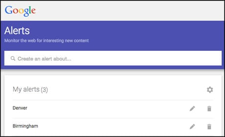
Screenshot from Google Alerts
Do you have any more recommendations of location-based web tools for newsgathering or journalism in general? Feel free to let us know in the comments below.
Related articles: