Advice from ABC News: how to get started with satellite journalism
Mark Doman is at the heart of ABC News' satellite journalism. In this Q&A he runs through the essentials to using satellite imagery in investigations

– 5 min read
Mark Doman is at the heart of ABC News' satellite journalism. In this Q&A he runs through the essentials to using satellite imagery in investigations
This article was migrated from an old version of our website in 2025. As a result, it might have some low-quality images or non-functioning links - if there's any issues you'd like to see fixed, get in touch with us at info@journalism.co.uk.
Satellite journalism has been said to hold much promise for data-driven, investigative journalism.
As Mark Corcoran, senior reporter at ABC News, wrote last year in a report on Reuters Institute for the Study of Journalism, it is becoming easier to learn how to use technology although some organisations still cannot afford to pay for the tools. That said, satellite imagery provides practical means for verifying information, newsgathering and storytelling.
Corcoran also warns the risk of misinterpreting images means journalists need to be cautious and seek expert opinion if in doubt.
As one example last year, the BBC looked into China's hidden camps in Xinjiang using satellite images to show the steady construction of buildings in the country over a three-year period.
Coupled with on-the-ground reporting, they confirmed claims that the buildings were 're-education schools' used to indoctrinate ethnic minorities.
It was an effort closely followed by ABC News in similar style to expose the expansion of Chinese detention camps in a visual timeline. However, ABC News has also applied satellite imagery to show the devastation caused by wildfires and track flood waters in parts of Australia.
Mark Doman, journalist and producer on the digital story innovations team at ABC News, has been at the heart of satellite journalism investigations at the organisation. He spoke to Journalism.co.uk on how to get started with satellite imagery.
Tweet content
— User View on Twitter
For someone who has never stepped foot into satellite journalism, what would be the first step to getting started?
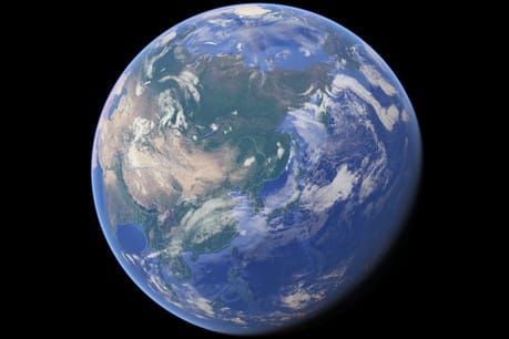
I would start by getting some inspiration. NASA and ESA regularly post amazing images from their satellites and a quick trawl through their archives should get the creative juices flowing. Citizen journalism group Bellingcat is a great place to check out for investigations using satellite imagery and they also have some brilliant resources for journalists. Then I would start trying to get your own images or try to recreate the ones you have seen from the space agencies. This will give you a great sense of the pros and cons of the different satellites and will be a good launching pad for future projects.
How do you access these images and how do you authenticate them?
There are plenty of great options these days for getting your hands on satellite imagery. My go-to sites at the moment for free imagery are usually the USGS Earth Explorer, the Sentinel Hub and, of course, Google Earth Pro. There are other paid services, but if you are just getting started and want to explore some satellite images these services are a good place to start.
They each have their own pros and cons, like, for example, the hi-res imagery on Google Earth can often be months or years old or imagery from a NASA satellite can be more timely but the quality isn’t as good and can often be also a gigabyte in size for one tile.
There are other options, such as going to the satellite companies themselves, like Planet and DigitalGlobe. They are sometimes generous enough to provide imagery free of charge to media organisations but, obviously, they would prefer it if you paid. In my opinion, getting access to high quality, up-to-date satellite imagery has never been easier. Knowing what to look for when you get it is the tricky part.
How do you make sense of satellite imagery?
There are various ways to start making sense of what you are looking at in the imagery. More often than not that process starts by getting to know what things looked like on the ground beforehand. I have done that in a range of different ways before, from chatting to experts who know the area you are looking at well, to combing through photos taken from the ground that line up with the area you are looking at. Historical satellite imagery is also an amazing tool you can use to give you a better sense of how areas have changed over time and start giving you a timeline of how things have changed in a region.
Other advantages versus disadvantages?
Clouds. I hate clouds! There is nothing worse than waiting for satellite imagery to come through and on the day you are looking at it is cloudy. It always seems to happen on the most important days.
It can be time-consuming. From waiting for a satellite to pass over the region you are looking at, to processing that imagery when it comes through then onto the analysis, the whole process can take weeks, if not months for big projects.
But for me the payoff is worth it, showing our audience a perspective of the world many have never seen before is immensely rewarding and from my experience, the audience response has been extremely positive. It also offers an untainted view of what is happening on the ground at any given time, which can be an incredibly powerful tool for journalists.
What technical ability is required?
It really depends on what you are trying to achieve. If the aim is to look at how an area has changed over time. Then I would say that most people with basic computer skills could do that. Even if you are trying to see changes after or during a natural disaster for example, that is relatively easy to source these days with the Sentinel and Landsat satellites.
But that is very much the baseline. The data captured by the satellites is both phenomenal and somewhat overwhelming. When you see the way researchers and programmers are using this data to monitor what is happening on Earth, it really is incredible and has encouraged me to learn new and better ways of using this data.
But as always, Google and Youtube are your friends, so if you get stuck or do not even know where to start, just search for it because there are plenty of great resources out there.
Are satellite images beyond dispute and does it put to rest the fake news argument?
I think satellite images are one great tool journalists can use in the verification of stories. Sometimes the images captured from space can be the smoking gun, but I think more often than not they are one element in a body of evidence in an investigation. Images captured over time help us corroborate information from interviews with people on the ground or, as was the case with our China investigation, match up official tender documents with a timeline of construction.
Finally, did you run into any censorship issues with any of your work?
If anything, using satellite imagery has helped us counter censorship issues. In Xinjiang, for example, a region notorious for being a reporting blackhole, satellite imagery allowed us to watch the rapid expansion of detention camps locking up ethnic minorities. With the help of experts from the Australian Strategic Policy Institute, we were able to use what we were seeing from the satellites to debunk propaganda being disseminated about the region.
Obviously, nothing can replace boots on the ground but in places where reporting is so heavily restricted, the satellite imagery allowed us to spend months observing the region and build a body of evidence about the speed at which China was ramping up its secret campaign of mass detention in Xinjiang.