Live UK flood maps made available to all news outlets
Environment Agency contractor Shoothill provides embeddable interactive maps and Twitter accounts for over 2,400 river gauges ahead of flood season
– 3 min read
Environment Agency contractor Shoothill provides embeddable interactive maps and Twitter accounts for over 2,400 river gauges ahead of flood season
This article was migrated from an old version of our website in 2025. As a result, it might have some low-quality images or non-functioning links - if there's any issues you'd like to see fixed, get in touch with us at info@journalism.co.uk.
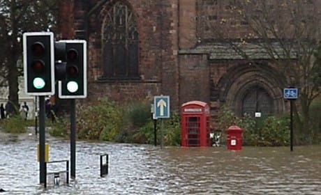
Some news outlets are already reporting the possibility of an Indian Summer for the UK after a week of above average temperatures, but the same was said last autumn, shortly before one of the wettest winters on record.
The storms and floods of 2013/14 destroyed local infrastructure and damaged homes in the thousands. So following the Environment Agency's decision to open up their flood data under the Open Data Initiative in February, visualisation specialists Shoothill have made their live flooding map and data available to all for free.
"There's a lot of maps out there but a lot are over complicated for the average user," Rod Plummer, managing director of Shoothill, told Journalism.co.uk. "When there's flooding most people don't give a monkey's about all the other information, they just want to know if there's a flood risk."
Users can get direct access to three data sets – FloodAlerts, River Level or 3-Day Flood Forecast – by contacting Shoothill and receiving the data direct through an API.
Alternatively, they can request access to the FloodAlerts map to embed on their website and keep readers updated with local events.
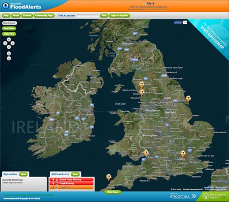
Screengrab from Shoothill.com of the live FloodAlert map
Already in use at the BBC, the FloodAlerts map updates every 15 minutes with pins highlighting official flood alerts around the country.
Users can register to get email or Facebook alerts when a flood warning is issued for a designated area, and news organisations can embed the map on their websites.
"It's a much more dynamic way of reporting on floods," Plummer said. "Previously the problem was, certainly in February [2014], there was something like 600 flood alerts at any one time.
"But then the map is covered in pins, there are floods everywhere, but which are the ones that people are bothered about? It's the local ones. You don't care about the ones 150 miles away, you care about what's local.
"So all national or local news outlets can have a version of the map that we can embed on their website."
Using the River Level data, Shoothill has also built GaugeMap to show the status of more than 2,400 river gauges around England and Wales, each with its own colour-coded pin to show flood risk, graph for recent levels and search function to look up regions or rivers.
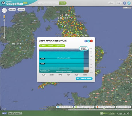
Screengrab from GaugeMap.co.uk of the GaugeMap and river level at one gauge
Every gauge also has its own Twitter account, automatically tweeting river level updates twice a day and organised into Twitter lists relevant to individual river s around the country.
"The trouble with the internet is that when you want to find something out you often have to go to a number of different websites," Plummer said. "The idea with the Twitter hook up is you can see the gauges there, you don't have to go to a different website to find it. You can just follow it on Twitter."
Plummer hopes the maps and data will help local and national news organisations have quicker access to more live data on flooding in the UK, therefore helping communities prepare and limit damage.
Whether it will stop leading politicians arriving at flood plains in wellies to point at large amounts of water remains to be seen.
Shoothill is contracted by the Environment Agency.